US States according to watershed based on John Wesley Powell's 19th century proposal [1700x1100]6yr ⋅ 7LeagueBoots ⋅ r/MapPorn
Termite mound [1920 × 3321] - previous post was deleted for some reason, trying again6yr ⋅ 7LeagueBoots ⋅ r/ThingsCutInHalfPorn
North Sea Countries if All Glaciers were to Melt (sea level rise of 70 m)[OC][7015x4950]4yr ⋅ 7LeagueBoots ⋅ r/MapPorn
South America if ALL (continental and alpine) Glaciers Melted - a sea level increase of 70 meters (230 feet) [OC][4690x7015]4yr ⋅ 7LeagueBoots ⋅ r/MapPorn
Greater New Zealand (if the sea were 200 meters lower than present) [OC]4yr ⋅ 7LeagueBoots ⋅ r/MapPorn
Lepidodendron fossils, Brandon Page, Graves Gap Formation, Morgan County, Tennessee by Chuck Sutherland6yr ⋅ 7LeagueBoots ⋅ r/geology
World Map of Natural Hazards (NATHAN database of earthquakes, cyclones, volcanoes, tsunamis, wildfires, tornados, el nino and more) [3410 × 2407]6yr ⋅ 7LeagueBoots ⋅ r/MapPorn
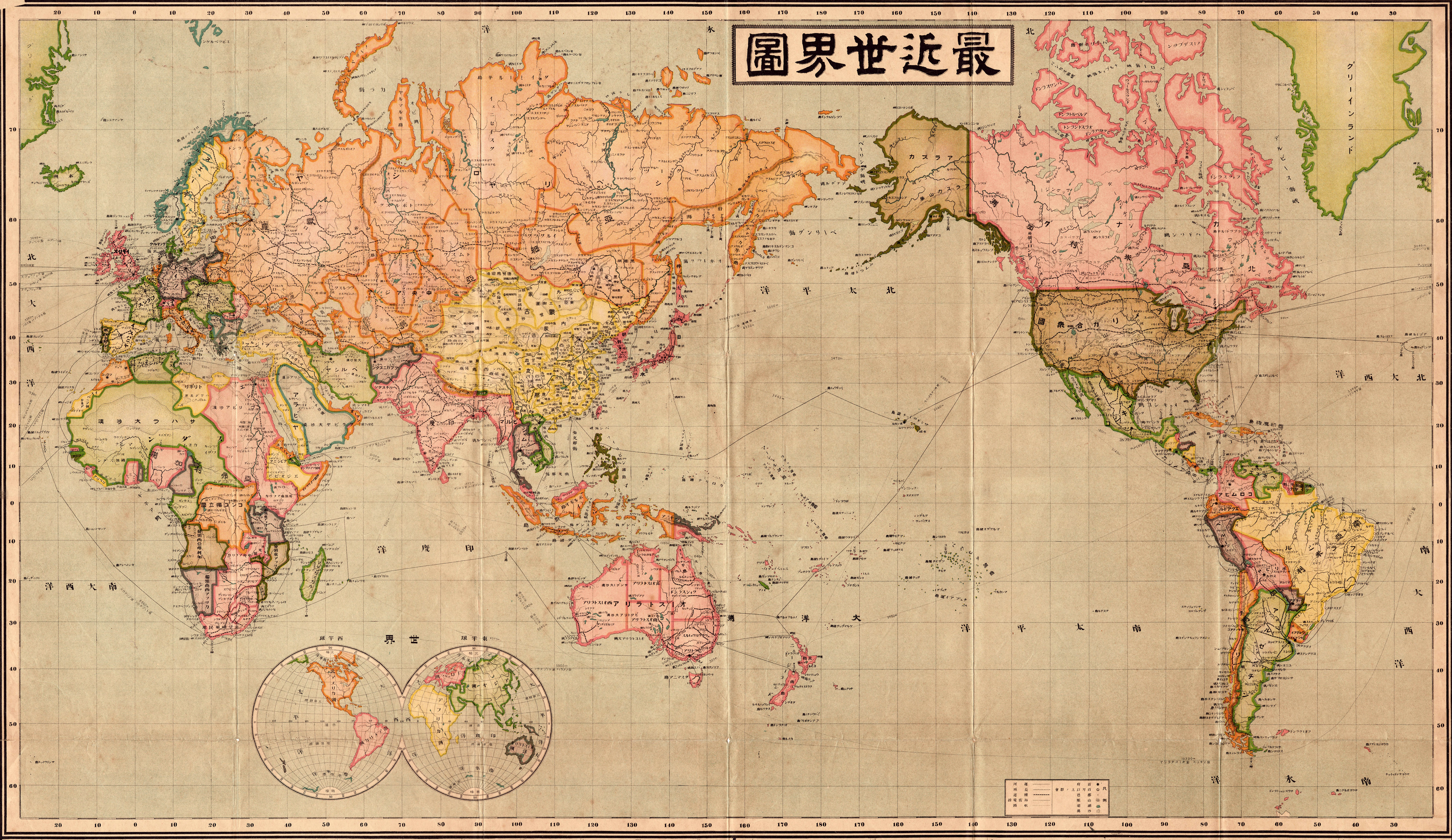
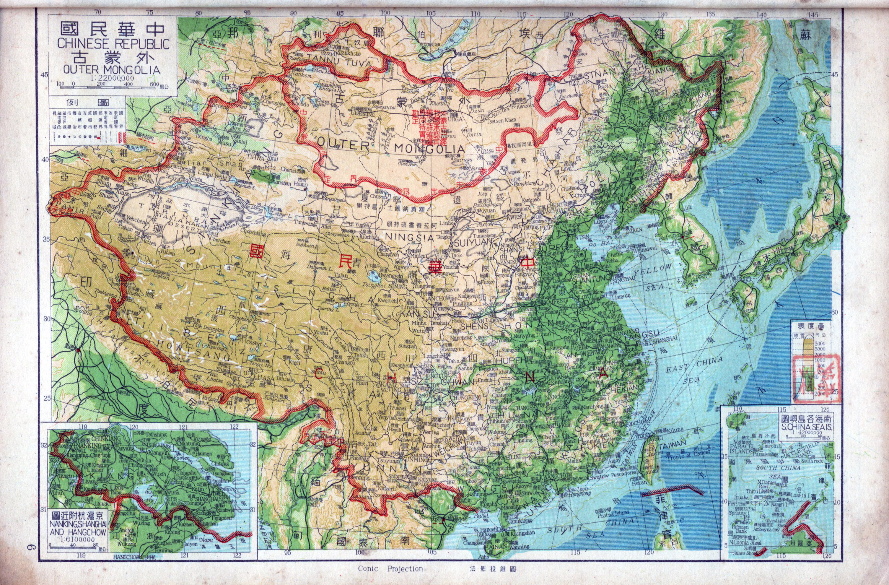
Pre-1944 Chinese topographic map (between 1921 and 1944 based on the presence of Tannu-Tuva) [3010x1908]7yr ⋅ 7LeagueBoots ⋅ r/MapPorn
Scribble map of the contiguous US drawn by zipcode sequential order [1676x977]6yr ⋅ 7LeagueBoots ⋅ r/MapPorn
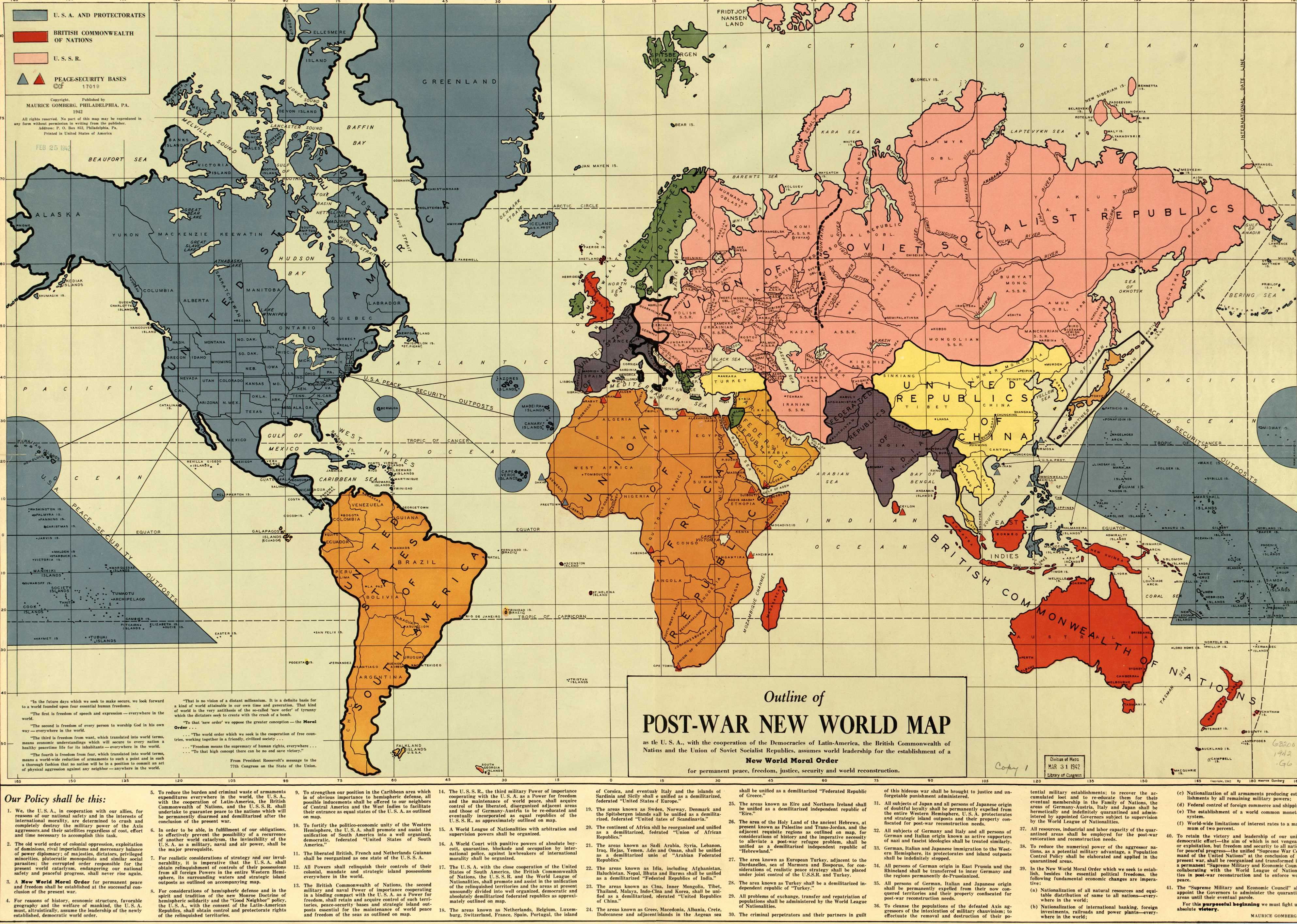
Maurice Gomberg's 1942 *Outline of the Post-War New World Map* drawn prior to the end of WWII[3972x2832]6yr ⋅ 7LeagueBoots ⋅ r/MapPorn
Cheetah subspecies (dark indicates current range, light pre-1900 range)[1224×792]6yr ⋅ 7LeagueBoots ⋅ r/MapPorn
Extremely detailed map of Cuba by Erwin Raisz & Gerardo Canet 1945 [7150 × 2650]6yr ⋅ 7LeagueBoots ⋅ r/MapPorn
Soil Map of Iran, Afghanistan, and Central Asia 1961 (English and Persian languages) [7696 × 5957]6yr ⋅ 7LeagueBoots ⋅ r/MapPorn
Principal Rivers of the World from A New Universal Atlas Containing Maps of the various Empires, Kingdoms, States and Republics of the World. Augustus S. Mitchell, 1849 [4940 × 3907]6yr ⋅ 7LeagueBoots ⋅ r/MapPorn
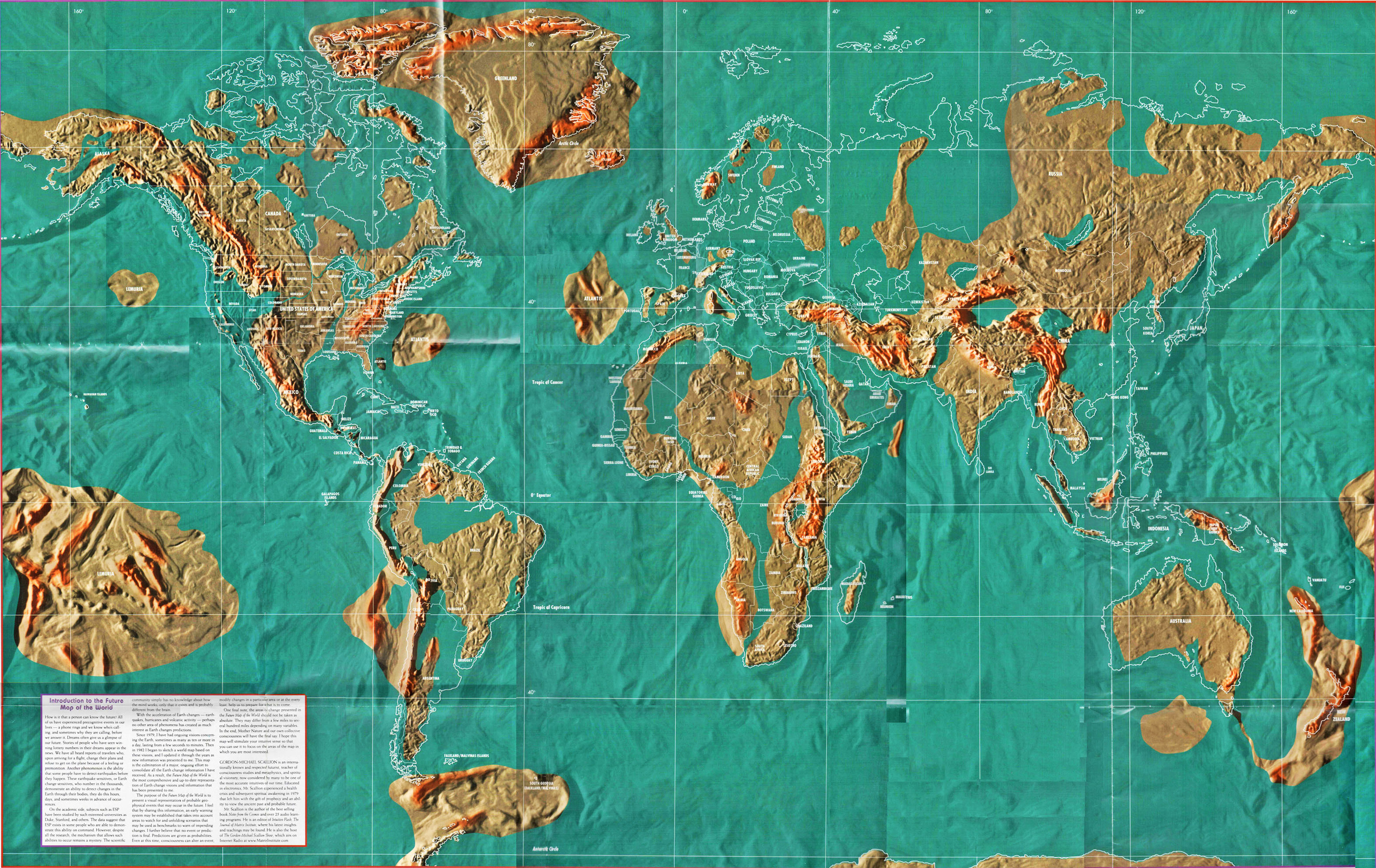
Gordon-Michael Scallion's world map based on his visions of the future[3500x2208]6yr ⋅ 7LeagueBoots ⋅ r/MapPorn
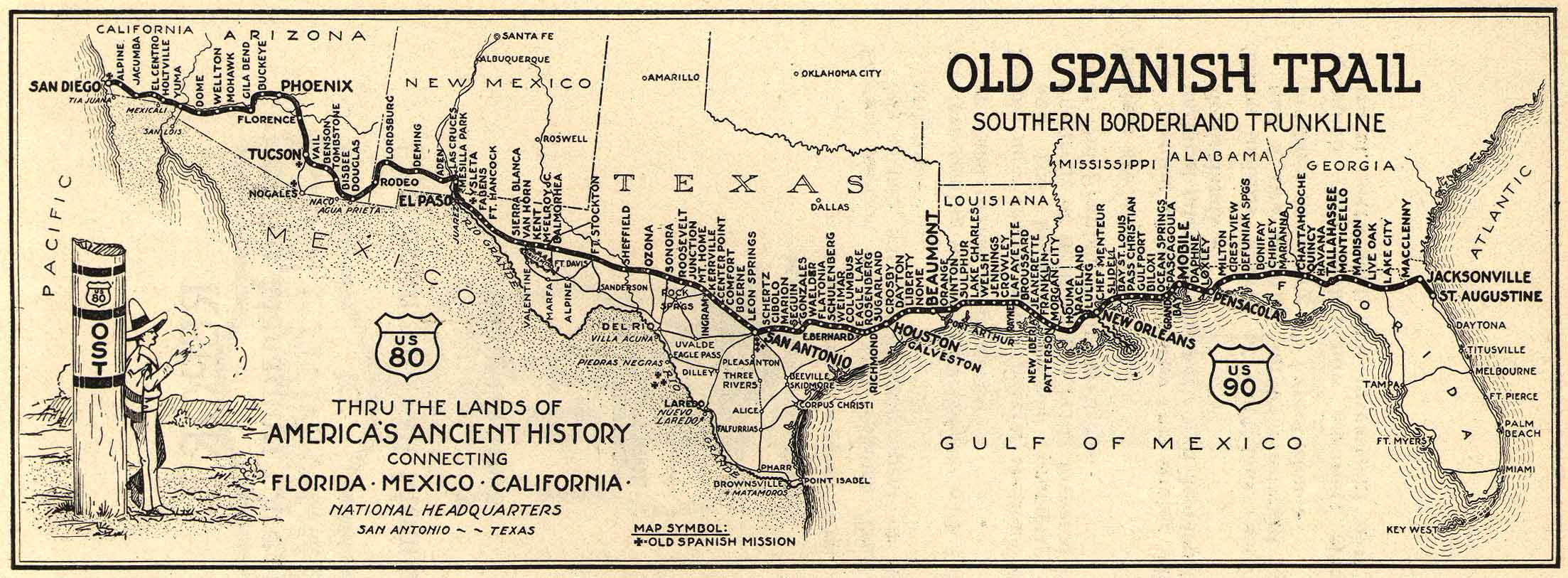
Old Spanish Trail: Southern Border Tunkline (1920s) - now Interstate 10 [2207 × 813]6yr ⋅ 7LeagueBoots ⋅ r/MapPorn
Highest shoreline of the Baltic in post-glacial Finland, 11,000-9,000 BP [400x690] - source in comments7yr ⋅ 7LeagueBoots ⋅ r/MapPorn
Nearest brewery Voronoi map USA (link to interactive map and article in comments)[5000x3231]6yr ⋅ 7LeagueBoots ⋅ r/MapPorn
Earth splayed out along tectonic boundaries - cut and tuck type map can be assembled into a responsive globe[4311x3301]7yr ⋅ 7LeagueBoots ⋅ r/MapPorn
San Antonio Creek, Oakland, CA 1857 U.S Coast Guard Survey [4000 × 2879]6yr ⋅ 7LeagueBoots ⋅ r/MapPorn
Columbia Highway, Oregon America's Premiere Scenic Asset 1915 [2000 × 1299]6yr ⋅ 7LeagueBoots ⋅ r/MapPorn
I am working on keeping the Cat Ba Langur (one of the most endangered primates in the world) from going extinct. Yesterday I came across a juvenile scampering across the limestone cliffs and made a GIF of it moving. [OC]10yr ⋅ 7LeagueBoots ⋅ r/zoology
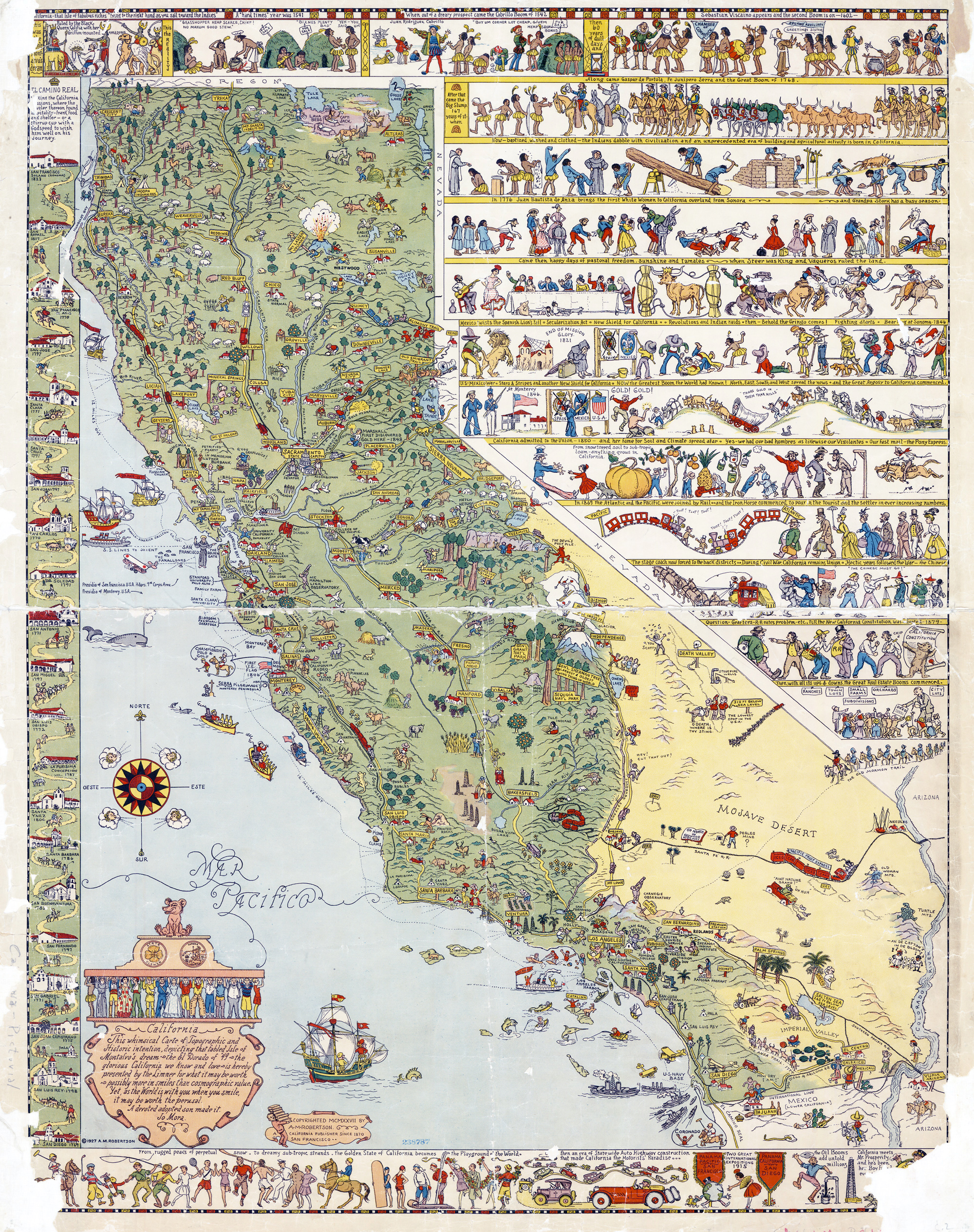
6 Ways to Divide California (from the California State Department of Justice) [981x734]6yr ⋅ 7LeagueBoots ⋅ r/MapPorn
Help identifying coin and date? Found in shell midden in Northern Vietnam - more info in comments4yr ⋅ 7LeagueBoots ⋅ r/coins
Repairs at Ta Keo, one of the many temples in the larger Angkor Wat complex [OC]9yr ⋅ 7LeagueBoots ⋅ r/Archeology
Colorized shaded-relief 2km map of Mercury from the Mercury MESSENGER spacecraft[7664x3832]6yr ⋅ 7LeagueBoots ⋅ r/MapPorn
Arctic Sea Ice 1981-2010 for the month of April sorted by number of years area has been covered - also showing Ringed Seal foraging area [6600x5100][OC]11yr ⋅ 7LeagueBoots ⋅ r/MapPorn

_-_Geographicus_-_SanAntonioCreek-uscs-1857.jpg)