Could somebody explain this to me? (Plane thats divided into color and b/w on satellite imagery)11mo ⋅ SASdohlen ⋅ r/remotesensing
Growth of Rohingya refugee camps in southern Bangladesh (Sentinel 2 images)3yr ⋅ UnoStronzo ⋅ r/remotesensing
I am trying to figure out how to fix the color difference in this mosaic image I created using ArcGIS pro. The images I used to create this mosaic are from Landsat 8 and are all from the same date.2yr ⋅ roflcopterzomg ⋅ r/remotesensing
Software for co-registration of aerial imagery to correct for orthorectification differences? (Question in comments)3yr ⋅ iamvegenaut ⋅ r/remotesensing
Need help with band composition of Landsat 8. More details are in the comments.2yr ⋅ plankmax0 ⋅ r/remotesensing
Undergrad student question: Is that dark area just clouds? This is around lake Lanier GA. If you zoom in on the picture the distortion goes away. Thanks guys!4yr ⋅ OopsIForgotLol ⋅ r/remotesensing
Why does the baseline for this GEDI waveform start at around 30 along the y axis? Instead of at zero?4yr ⋅ LeoCrimson1 ⋅ r/remotesensing
Hello everyone! I'm new to RS. I'd like to know if it's possible to create 3D maps from the output images of the supervised classification process. If so, how can I do this? Thanks in advance!4yr ⋅ dbensons ⋅ r/remotesensing
Does anyone know how to extract time, relative height (RH) metrics, or amplitude from this lidar HDF5 data file produced by the GEDI space instrument (NASA lidar scanner)?4yr ⋅ LeoCrimson1 ⋅ r/remotesensing
Question for my remote sensing class: What is the blue stuff? Is it ice, rain in clouds? This is in the Tibetan area.4yr ⋅ Builder365 ⋅ r/remotesensing
First waterskier captured from space? 2015-08-21, 10:21:02Z @ Lat 36° 5'43.83, Long 28° 5'14.65 by Urthecast-IRIS9yr ⋅ spacenadir ⋅ r/remotesensing
Why is there always a strong radar return over Travis AFB and not over SFO or OAK?8yr ⋅ MrSpectroscopy ⋅ r/remotesensing
How can I run analysis on Hyperspectral this large? I have 299 bands and I cannot run any sort of spectral analysis on ENVI without it crashing. Any tips?6yr ⋅ tericket ⋅ r/remotesensing
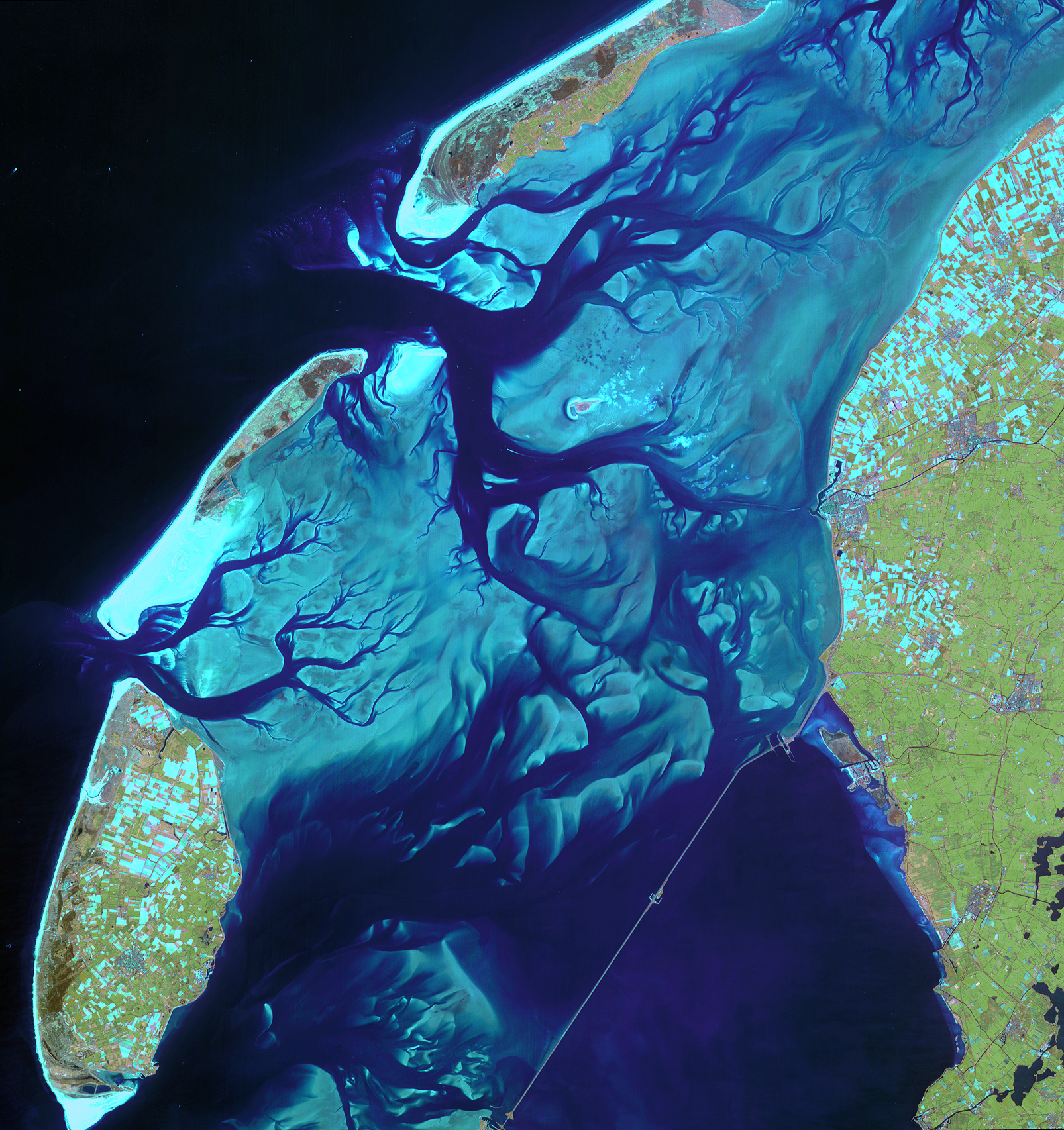
Need help with structure identification/location. Only clue is that its on the North American Atlantic Coast.10yr ⋅ spatialodditie ⋅ r/remotesensing
